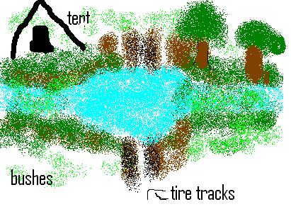
This is the site survey for Douglas Creek site 2 on May 9, 2011.The survey people are Hailey Kaden Braylen Taylor and Mr. Moreno.
First I will tell you of the riparian zone. The width for left bank is 0-50ft. and the right bank is 0-50ft. The vegetation has no conifer trees and deciduous is abundant. Shrubs are abundant and grasses and herbs are abundant. The overhead canopy is 50-75%.
Next I will tell you about the channel. The channel is what area the stream flows in. The shape cross section is steep sides and a flat bottom. The longitudinal pattern is braided and the gradient is moderate.
Next I will tell you about the stream banks. The vegetation on the stream bank is abundant. The protection is 0-25%. The banks stability has erosion in some areas.
We also surveyed the habitat in our reach. The number of riffles is about 10. The number of pools are 1. The percentage of riffles is 50-75% the percentage of the pools is 25%.
Now I will tell you about the land use adjacent to the stream. We have a road and there are camping spots. Also we had tire tracks in to the stream. We have some artificial structures like litter and garbage.
Monday, June 6, 2011
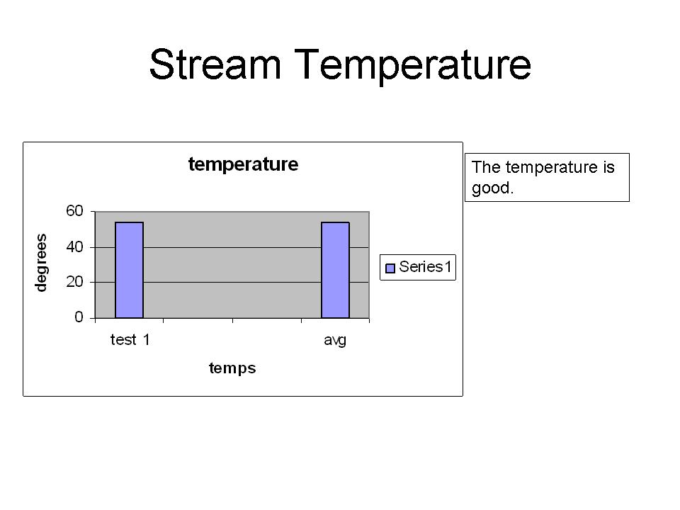
water quality results
The average pH for site 2 in 2010 was 7.5. That means plants, catfish, and some insects can live there. Also bass, crappie, snails, clams, mussels, larger variety of organisms (salmon trout, may flies caddis flies stoneflies. Nest I will tell you about the temperature.
What we had for Test 1 was temp 54 & that is good for Test 2 &3 we did not do but for avg. it was 54 too.
What we had for Test 1 was temp 54 & that is good for Test 2 &3 we did not do but for avg. it was 54 too.


Subscribe to:
Posts (Atom)