Wednesday, May 27, 2009
Friday, May 22, 2009
Thursday, May 14, 2009
site survey 5/8/09
May 8, 2009
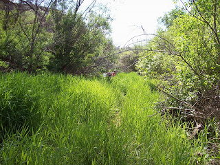
We are going to tell you about site #2. Our stream reach is 100 feet. First we will tell you about the Riparian Zone. The left bank looking downstream is 50-100 ft. The right bank looking down stream is 0-50ft. There are no conifer trees, moderate deciduous trees, there are abundant shrubs and grasses/herbs. Our overhead canopy was 0-25%.
Next we will tell you about our channel. Our shape in cross-section is a nice flat bottom and steep sides. Our longitudinal pattern is meandering. The gradient is low.
Now we will tell you about stream banks. Our vegetation cover is abundant. Artificial bank protection is 0-25%. The bank stability is the bank is intact.
Another thing we will tell you is the reach habitat. The number of riffles is 20 and 2 pools. Woody debris is sparse and organic debris is moderate.
We will also tell you about artificial structures (man made). We only have garbage/ litter and 4 wheeler tracks.
Finally we are going to tell you about the land uses at site#2. We only saw recreation was present.
Subscribe to:
Posts (Atom)


